12/9/12 Green Cove Springs, FL
12/10/12 Santos Trails, Ocala, FL
12/12/12 "The Beast" St. Francisville, LA
12/12/12 Mississippi River Trail, New Orleans, LA
12/13/12 Rocky Hill Ranch, Austin, TX
12/14/12 Big Bend Ranch State Park, TX
12/15/12 Fire Road to Signal Peak, NM
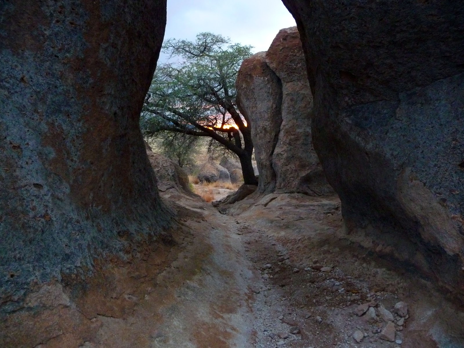
12/16/12 Casa Grande, AZ
12/17/12 Black Canyon Trails, Phoenix, AZ
12/17/12 Cathedral Rock Trail, Sedona, AZ
12/19/12 Bootleg Canyon Trails, Boulder City, NV
12/21/12 La Tuna Canyon Trails, Glendale, CA
12/21/12 Kanan Dune/Backbone Trail, Malibu, CA
12/22/12 San Juan/Los Pinos Trail, Lake Elsinore, CA
12/26/12 Humboldt Redwoods State Park, CA
12/27/12 Swassy and Whiskeytown Recreation Areas, Redding, CA
12/29/12 Gooseberry Mesa, St. George, UT
12/30/12 Moab Brand Trails, Moab, UT
1/1/13 Waterton Canyon Fire Road, Littleton, CO
1/2/13 Dinosaur Valley State Park, Dallas, TX
1/3/13 Lincoln Parish Park, Ruston, LA
1/4/13 Tsali Trails, Bryson City, NC
1/4/13 Bent Creek Trails, Asheville, NC
1/5/13 Dark Mountain/Overmountain Victory Trails, Wilkesboro, NC
Thursday, January 10, 2013
Wednesday, January 9, 2013
Additional Photos
 |
| The vending machine outside Berdoll Pecan Farm near Austin Those are 12" pecan pies at the bottom for $19.50 |
 |
| Southwest Texas |
.JPG) |
| Warming breakfast in the middle of nowhere, TX |
 |
| How Lajitas, TX outside Big Bend Ranch State Park gets their packages |
 |
| The only decent shot I got at City of Rocks, NM |
 |
| Black Canyon Trails, AZ |
 |
| Closeup of a saguaro. The hostility is not an exaggeration, very sharp! |
edit.jpg) |
| Black Canyon Trails Trail goes this way |
edit.jpg) |
| Cliff making clouds, north of the Grand Canyon |
 |
| At the entrance to the Bootleg Canyon Trails near Las Vegas, NV |
cropped.jpg) |
| I suspect cheap Mexican beer... Bootleg Canyon Trails |
edit.jpg) |
| La Tuna Canyon Trail goes this way |
 |
| Backbone Trail, Malibu, CA |
 |
| Los Pinos Trail |
 |
| Overlooking Diablo, CA |
 |
| North of San Francisco on The Shoreline Highway |
 |
| Night shot in Humboldt Redwoods State Park, drowning fern. |
 |
| Trail in Humboldt Redwoods State Park. |
 |
| Somewhere east of Reno |
 |
| Leaving Lunar Crater, serene |
 |
| The Extraterrestrial Highway. |
 |
| 1°F Somewhere near the Nevada/Utah border at ~9000 ft. |
 |
| Gooseberry Mesa Trail goes up this way |
 |
| View from the north rim of the Gooseberry Mesa |
 |
| View from the south rim of the Gooseberry Mesa, looking towards Zion National Park. |
 |
| Before entering Zion National Park |
 |
| Zion National Park |
.JPG) |
| Zion National Park |
 |
| Zion National Park, wide-angle with the GoPro |
 |
| Night landscape in Utah |
.jpg) |
| More night |
 |
| Gas station in Hanksville, UT dug into a cliff I didn't get to go inside, they closed early |
 |
| The overlook for the Sipapu Bridge, tiny people Natural Bridges National Monument |
 |
| Rolling the odometer in Moab |
 |
| Royal Gorge Bridge |
.JPG) |
| Sneak attack! Manitou Cliff Dwellings Museum |
 |
| Leaving Manitou Cliff Dwellings Thanks Kokopelli! |
 |
| Sunrise near the Tennessee/North Carolina border |
edit.jpg) |
| Overmountain Victory Trail, Wilkesboro, NC |
Sunday, January 6, 2013
The Mad Dash Home
The next stop on the trip was a 10 mile loop of trails in Northern Lousiana. The trails at Lincoln Parish Park are referred to as "world-class" by the local university and "one of the best trails in America" by the Louisiana Department of Culture, Recreation, and Tourism. Considering I've never heard of this trail from any other source I had to see what all the hype was about.
When half the state is a swamp, the term "mountainous" is relative. Don't get me wrong, this is a great little trail system. The clay soil that lends itself to drifting and power slides, the short climbs, the opportunities to get some air, there's fun stuff here. Is it world class? No, but I think they've done the best with what they have and I would bet money its one of the best trail systems in the area. Also, they have a feature called the "ski-jump" which is a polished 120 ft descent into a jump ramp that ends in a 90º banked right turn.
.JPG)
With only 2 days left in the vacation, it was time to make a decision as to whether to continue as planned and head north through Arkansas and Tennessee or to detour east through Mississippi and Alabama. Unable to find a good destination in Tennessee that was halfway between Louisiana and home, I decided to continue east. It was a 10 1/2 hour drive to Asheville, NC. At a pit stop in Jackson, MS I think I found my favorite souvenir of the trip.
.JPG)
The first stop in North Carolina was the Tsali Trail System. I've been here before, but this IMBA Epic is one that is worth visiting on a regular basis. Situated along Fontana Lake, this trail system consists of several loops with suggested routes of travel that give short, relatively steep climbs followed by long descents. Its like one giant roller coaster of (mostly) silky smooth trail. It was interesting to ride this one in the winter. The trails were frozen and just starting to thaw, the green rhododendron bushes seemed to glow against all the brown, the low water level of the lake. Still very fast, and very worthwhile.
.JPG)
From here I was able to make it to another highly rated trail system in Asheville: Bent Creek Experimental Forest. I had high hopes for this one, but I just wasn't feeling it. Maybe it was all the mud, or maybe just because my legs were shot from Tsali. In hindsight, I probably should've made more of an effort to find the "Green's Lick" trail that judging from all the reviews must be either the best trail known to man or completely littered with mind-altering drugs. But at 3 PM on Friday, the parking lot was already full and on the trail I kept running into other non-biking trail users. To make matters worse, someone must've been fed up with all the mountain biking because I found several branches strategically placed at neck height going across the trail. Not cool. Honestly with how muddy it was I don't know why anyone would be out hiking. To each their own. At least the people that lived close to the park seemed cool.
.JPG)
Saturday was the last day of the trip and I had just enough time to get one more ride in. There are two trails in Wilkesboro that are always worth a detour when I visit Tsali, and not just because I have family in the area. The Dark Mountain Trail and The Overmountain Victory Trail are truly unexpected for such a rural area. Whoever designed these trails is very gifted. Dark Mountain offers climbs, roots, and flow, ending with a playground of a downhill. Overmountain its relatively flat and smooth out-and-back that banks corners like theres no tomorrow, and is ridiculously fast. Its a winning combination of trails in my book.
Last stop on the trip was lunch with the family. Showing up on short notice is the best way to find out which family members truly love you (just joking Aunt Susan). Thanks again everyone! I know I need to visit more often.
Finally got home a little after midnight last night. 11803.3 miles in the car, 380.2 miles on the bike, 18 states, and countless forests, parks, monuments, and friends. All in all, the trip was an awesome experience and definitely one of the most worthwhile endeavors I've undertaken in quite some time. With the grueling pace, I'm still trying to comprehend a lot of what I've seen in the past 2 weeks. Visiting Crystal seems like much longer than a month ago.
I guess this is where I admit that out of the last 30 nights, 21 were spent sleeping in the car. Despite outward appearances, I'm not made out of carbon bicycles and month long road trips. But if I had waited for that perfect moment to do the trip: when the weather would be ideal, where I'd have enough cash to burn on a hotel every night, when I didn't have other things already planned, it was never going to happen. Sometimes its important to just get things done, life's too short to sit around and wait.
When half the state is a swamp, the term "mountainous" is relative. Don't get me wrong, this is a great little trail system. The clay soil that lends itself to drifting and power slides, the short climbs, the opportunities to get some air, there's fun stuff here. Is it world class? No, but I think they've done the best with what they have and I would bet money its one of the best trail systems in the area. Also, they have a feature called the "ski-jump" which is a polished 120 ft descent into a jump ramp that ends in a 90º banked right turn.
.JPG)
I wonder if this has anything to do with that "helmets are now required" sign.
With only 2 days left in the vacation, it was time to make a decision as to whether to continue as planned and head north through Arkansas and Tennessee or to detour east through Mississippi and Alabama. Unable to find a good destination in Tennessee that was halfway between Louisiana and home, I decided to continue east. It was a 10 1/2 hour drive to Asheville, NC. At a pit stop in Jackson, MS I think I found my favorite souvenir of the trip.
.JPG)
Look Ma! I made the paper.
The first stop in North Carolina was the Tsali Trail System. I've been here before, but this IMBA Epic is one that is worth visiting on a regular basis. Situated along Fontana Lake, this trail system consists of several loops with suggested routes of travel that give short, relatively steep climbs followed by long descents. Its like one giant roller coaster of (mostly) silky smooth trail. It was interesting to ride this one in the winter. The trails were frozen and just starting to thaw, the green rhododendron bushes seemed to glow against all the brown, the low water level of the lake. Still very fast, and very worthwhile.
.JPG)
Much more aesthetic in the summer.
From here I was able to make it to another highly rated trail system in Asheville: Bent Creek Experimental Forest. I had high hopes for this one, but I just wasn't feeling it. Maybe it was all the mud, or maybe just because my legs were shot from Tsali. In hindsight, I probably should've made more of an effort to find the "Green's Lick" trail that judging from all the reviews must be either the best trail known to man or completely littered with mind-altering drugs. But at 3 PM on Friday, the parking lot was already full and on the trail I kept running into other non-biking trail users. To make matters worse, someone must've been fed up with all the mountain biking because I found several branches strategically placed at neck height going across the trail. Not cool. Honestly with how muddy it was I don't know why anyone would be out hiking. To each their own. At least the people that lived close to the park seemed cool.
.JPG)
Take note: the correct riding position.
Saturday was the last day of the trip and I had just enough time to get one more ride in. There are two trails in Wilkesboro that are always worth a detour when I visit Tsali, and not just because I have family in the area. The Dark Mountain Trail and The Overmountain Victory Trail are truly unexpected for such a rural area. Whoever designed these trails is very gifted. Dark Mountain offers climbs, roots, and flow, ending with a playground of a downhill. Overmountain its relatively flat and smooth out-and-back that banks corners like theres no tomorrow, and is ridiculously fast. Its a winning combination of trails in my book.
Make way! Damn Yankee coming through!
Last stop on the trip was lunch with the family. Showing up on short notice is the best way to find out which family members truly love you (just joking Aunt Susan). Thanks again everyone! I know I need to visit more often.
Finally got home a little after midnight last night. 11803.3 miles in the car, 380.2 miles on the bike, 18 states, and countless forests, parks, monuments, and friends. All in all, the trip was an awesome experience and definitely one of the most worthwhile endeavors I've undertaken in quite some time. With the grueling pace, I'm still trying to comprehend a lot of what I've seen in the past 2 weeks. Visiting Crystal seems like much longer than a month ago.
I guess this is where I admit that out of the last 30 nights, 21 were spent sleeping in the car. Despite outward appearances, I'm not made out of carbon bicycles and month long road trips. But if I had waited for that perfect moment to do the trip: when the weather would be ideal, where I'd have enough cash to burn on a hotel every night, when I didn't have other things already planned, it was never going to happen. Sometimes its important to just get things done, life's too short to sit around and wait.
Thursday, January 3, 2013
Arches National Park, Colorado, North Texas
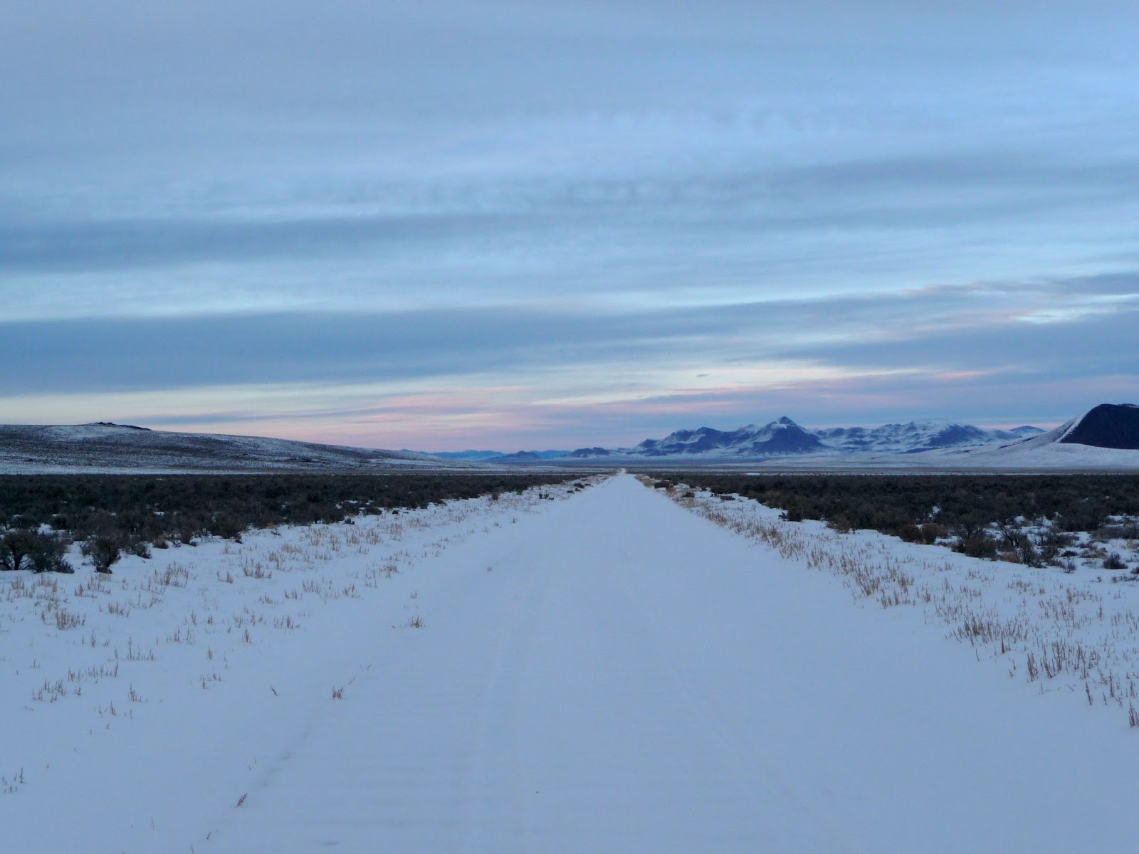
I got lucky in Moab and there was only an additional 2" of snow. Apparently they got about a foot of snow for Christmas and it took a couple days before everyone was plowed out. First stop was Arches National Park. This place has more arches than Natural Bridges National Monument, but they were all fairly small. I found the way all the rock formations moved past one another while I was driving more fascinating. Seeing a rising sun over a cloudy La Sal Mountain with snow covered dunes was unexpected, and out of my photographic abilities to capture. There were several professionals out taking photos that probably got much better shots than I did.

With sky getting cloudy, I decided it would be best to head to Colorado. Instead of going north and picking up the interstate, I went south and picked up Route 491. This used to be The Devils Highway, Route 666, until a bunch of prudes had it changed in 2003. Actually it was more likely because people kept stealing the signs. My trip down the fabled highway was uneventful. I turned off on Route 160 and made it to the Wolf Creek Pass at dusk. The Wolf Creek Pass crosses the continental divide at 10,800 ft and apparently has some spectacular scenery in the summer. In the winter though its nothing but fog, snow, and an 8% grade with hairpin turns. At the time I crossed only commercial vehicles were required to use snow chains, so I went for it. Other than having a little bit of trouble making it up one turn, it was also uneventful.
First thing the next morning it was off to see the Royal Gorge Bridge. The bridge crosses the gorge where its 850 ft wide and 950 ft deep. Due to the snow they wouldn't let me drive over the bridge, so a picture of the bridge over a shimmering frosty gorge will have to suffice.
.jpg)
Then, it was a trip to finally see some Indian cliff dwellings. Being my third attempt visit to one, I was excited to find that this one was actually open. As a bonus, this one wasn't in a state or national park and was setup more like a tourist attraction, which meant you could actually go inside and look around. I think this was a much better choice than the others in the parks where they've setup a hermetic barrier.
edit.jpg)
In the gift shop, the girl behind the counter apparently found herself here last year while doing a road trip and decided to stay. She also pointed to another woman who did the same thing 25 years ago. Women always giving men bad ideas... off to a ride with Luke.
Hillbilly Luke started the Fairhillbillies MTB Club back in Delaware, but moved out to Colorado shortly after I joined. He was nice enough to show me around Waterton Canyon, which connects to the Colorado Trail at the end of a 6 mile fire road. There was some nice scenery as the fire road followed a river through some steep mountains, but unfortunately there was a little too much snow on the Colorado Trail to get very far. Here we are coming back down after giving up.
At this point I'm getting tired of all the trails being closed, the snow on the ground, and the temperatures never getting above freezing. It was time to make a long drive south until there was no more snow. It was a long drive to Dallas. I took Route 287 which straddles the Texas-Oklahoma border. When the sun came up, it was flat, brown, and boring. I checked to make sure the car was still red and that I wasn't seeing everything in sepia. No wonder the government gave away all this land to homesteaders for free. I finally made it to Dallas to find that the Isle du Bois trails were closed due to wet conditions. Good thing I had a plan B. At the Dinosaur Valley State Park trails located 110 miles south, there was a burn ban in effect. Perfect.
This was a cool little trail system with lots of loose limestone. There were several places where the the trail crossed a stream on a giant slab of limestone. In one section there are fossilized dinosaur tracks in the limestone, but they were filled with mud and difficult to make out. There was also a 100 ft cliff overlooking the river that I'm surprised no one has accidentally ridden off.
.JPG)
As a bonus all the facilities were heated. The only downside to this place was all the dead wood laying around. If someone doesn't start clearing it out there's not going to be anything left here when it all catches fire.
After the ride I was able to catch up with an old friend from USC. It was good to see another engineer that hasn't gotten Silicon Valley fever.
Todays plan is to drive into mountainous Louisiana and check out some stuff over there. 9900 miles in, time for my second oil change. Lets see if they say anything about putting 5400 miles on the car in 15 days.

Pros also ignore the "stay on trail" signs.
First thing the next morning it was off to see the Royal Gorge Bridge. The bridge crosses the gorge where its 850 ft wide and 950 ft deep. Due to the snow they wouldn't let me drive over the bridge, so a picture of the bridge over a shimmering frosty gorge will have to suffice.
.jpg)
I mean, who wouldn't want to drive over that in the snow?!
Then, it was a trip to finally see some Indian cliff dwellings. Being my third attempt visit to one, I was excited to find that this one was actually open. As a bonus, this one wasn't in a state or national park and was setup more like a tourist attraction, which meant you could actually go inside and look around. I think this was a much better choice than the others in the parks where they've setup a hermetic barrier.
edit.jpg)
Must've been the wealthy cliff dwellers to get a view like that
Hillbilly Luke started the Fairhillbillies MTB Club back in Delaware, but moved out to Colorado shortly after I joined. He was nice enough to show me around Waterton Canyon, which connects to the Colorado Trail at the end of a 6 mile fire road. There was some nice scenery as the fire road followed a river through some steep mountains, but unfortunately there was a little too much snow on the Colorado Trail to get very far. Here we are coming back down after giving up.
...and then he dropped me. But no one needs to see that.
At this point I'm getting tired of all the trails being closed, the snow on the ground, and the temperatures never getting above freezing. It was time to make a long drive south until there was no more snow. It was a long drive to Dallas. I took Route 287 which straddles the Texas-Oklahoma border. When the sun came up, it was flat, brown, and boring. I checked to make sure the car was still red and that I wasn't seeing everything in sepia. No wonder the government gave away all this land to homesteaders for free. I finally made it to Dallas to find that the Isle du Bois trails were closed due to wet conditions. Good thing I had a plan B. At the Dinosaur Valley State Park trails located 110 miles south, there was a burn ban in effect. Perfect.
This was a cool little trail system with lots of loose limestone. There were several places where the the trail crossed a stream on a giant slab of limestone. In one section there are fossilized dinosaur tracks in the limestone, but they were filled with mud and difficult to make out. There was also a 100 ft cliff overlooking the river that I'm surprised no one has accidentally ridden off.
.JPG)
Too bad the river isn't deep enough to cushion a fall. Could be fun.
As a bonus all the facilities were heated. The only downside to this place was all the dead wood laying around. If someone doesn't start clearing it out there's not going to be anything left here when it all catches fire.
After the ride I was able to catch up with an old friend from USC. It was good to see another engineer that hasn't gotten Silicon Valley fever.
Todays plan is to drive into mountainous Louisiana and check out some stuff over there. 9900 miles in, time for my second oil change. Lets see if they say anything about putting 5400 miles on the car in 15 days.
Subscribe to:
Posts (Atom)